A virtual walking challenge your whole class takes together
Students' real steps carry them along a famous trail. eFit sizes the trail to your step goal, marks the landmarks as milestones, and lets students follow their progress on a map or in 3D.
Five famous trails
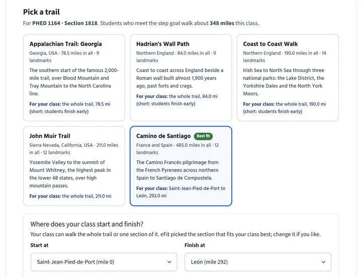
Walk a whole trail, or let eFit pick the section of a longer one that fits your class. Landmarks along the way become milestones. Mileages are approximate.
Appalachian Trail: Georgia
Georgia, USA
The southern start of the famous 2,000-mile trail, over Blood Mountain to the North Carolina line.
Hadrian's Wall Path
Northern England
Coast to coast across England beside a Roman wall built almost 1,900 years ago.
Coast to Coast Walk
Northern England
Irish Sea to North Sea through the Lake District, the Yorkshire Dales and the North York Moors.
John Muir Trail
Sierra Nevada, California
Yosemite Valley to the summit of Mount Whitney, the highest peak in the lower 48 states.
Camino de Santiago
France and Spain
The Camino Frances pilgrimage from the French Pyrenees across northern Spain to Santiago de Compostela.
What students see
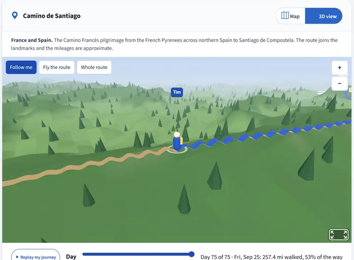
The journey page updates as steps sync, so every walk moves them forward.
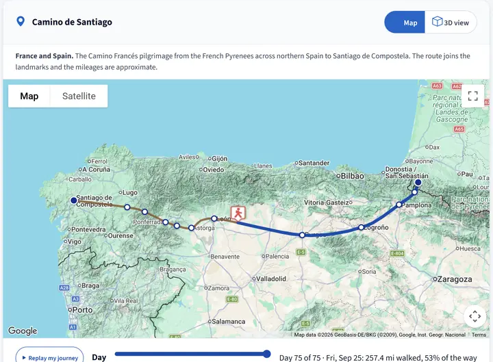
- Day-by-day replay of the walk so far.
- Classmates on the trail, shown without names once five or more are walking.
- Milestones and rewards that unlock as students reach each landmark.
Set up in four steps, or not at all
Every new Activity Tracker comes with a journey already fitted to the class. To choose your own, the setup wizard walks you through four steps: classes, journey type, trail or route, and rewards.
- Sized to your class. eFit shows how far a student who meets the goal will walk and marks the best-fitting trail.
- Or map your own route from campus to a destination with Google Maps.
- Share one journey across several sections of the same course.
Questions about Walking Journey
How does eFit decide how far my class walks?
eFit multiplies your daily step goal by five active days a week and the number of weeks in your tracker window, then converts steps to miles. It suggests the trail, or the section of a longer trail, that a student meeting the goal can finish.
Do I have to set up a journey for every class?
No. Every new Activity Tracker gets a journey automatically, fitted to the class. You can switch to a different trail, pick your own section, or map a custom route whenever you like.
Can students see each other?
Once five or more classmates are walking, students see them on the trail as unnamed markers, so no one can tell who is who.
Can I use my own route?
Yes. Pick a start, such as your campus, and a destination. Google Maps finds the walking route, and eFit suggests destinations that are about the right distance away.
Start your class on a trail
Walking Journey is part of every eFit course, alongside automatic activity grading and 12 interactive 3D labs. Students: $59 per student, per semester. Faculty accounts are free.